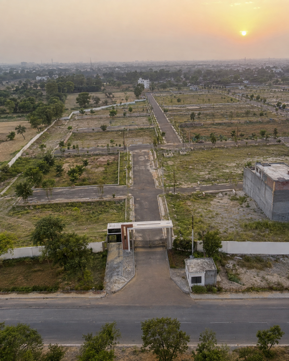
What the Kanpur Road belt around Banthra and Sarojini Nagar actually has today, what is still on paper, and which authority you will deal with when you buy a plot there.
Quick answer: The Kanpur Road belt around Banthra and Sarojini Nagar sits on the airport side of Lucknow, along NH-27, with the new 63 km Lucknow–Kanpur (Awadh) Expressway inaugurated on 13 July 2026. For a plot buyer the bigger question is not distance but authority: depending on the village, the layout may be approved by LDA, by the Lucknow Industrial Development Authority (LIDA), or by the Zila Panchayat.
This is the corridor where Hero Homes Lucknow is reported to be. That project has no UP-RERA number yet, so this guide is about the area, not about one project. It uses the village names that appear in recent UP-RERA filings in Brickly's data, plus public reports we could open and check.
Which villages make up "Kanpur Road" in the filings
Brokers say "Kanpur Road" or "Banthra" loosely. RERA filings use revenue villages, and that is what will appear in your sale deed. Recent registrations in Brickly's data within Sarojini Nagar tehsil include:
- Bhaukapur and Benti, Pargana Bijnor (JBBR Urban Paradise, which declares a green belt along its Kanpur–Lucknow highway frontage)
- Khatola, Pargana Bijnor (Ramayana City)
- Kaliyakheda (an LDA apartment project)
- Aurangabad Khalsa (a 30-plot layout, Krishika Infratech, in Ward Raja Bijli Pasi)
Before you go further with any plot, get the village and khasra number in writing. "Near Banthra" can mean very different villages with different authorities.
Roads: NH-27 and the new expressway
The old Lucknow–Kanpur highway is NH-27, and the two cities are about 85 km apart on it. It remains the road most local plotted projects open onto.
The Awadh Expressway (NE-6) is a 63 km, six-lane, access-controlled road that starts at NH-27 near Shaheed Path in south Lucknow and ends near Azad Marg in Kanpur. It has two raised sections on viaduct between Amausi and Bani, totalling about 12.5 km. It was inaugurated on 13 July 2026.
The opening has not been smooth. Wikipedia, citing The Economic Times of 18 September 2026, reports that stretches were damaged in the first rains, IIT Kharagpur experts recommended rebuilding affected parts, and toll collection was suspended along the whole road. For a plot buyer, the useful questions are where the nearest entry and exit is, and if your plot gets any direct access at all. An access-controlled expressway passing behind a colony does not mean the colony can use it.
The airport and metro side
Chaudhary Charan Singh International Airport is at Amausi, about 14 km from the city centre. It handled over 6.4 million passengers in 2024–25, and a third terminal has been built. The airport brings jobs and hotels to this side of the city. It also brings height limits: the 2025 UP building bye-laws say maximum building height is also governed by the airport funnel zone. If your plot is near the runway approach, ask the authority what height applies before you plan three or four floors.
The metro Red Line runs 22.878 km from CCS International Airport to Munshipulia with 21 stations, fully open since 9 March 2019. The airport station is its southern end. Transport Nagar station is on this side too. An extension from the airport to SGPGI was reported as planned in January 2024; treat that as a plan, not a timeline. Today, nothing on the metro reaches Banthra.
The industrial authority layer: LIDA
The Lucknow Industrial Development Authority was constituted by a state notification dated 28 July 2005, covering 49 villages of Lucknow and 34 of Unnao, under the UP Industrial Area Development Act, 1976. In 2008 Business Standard reported that LIDA's first phase would acquire 200 acres in four villages: Natkur, Banthra Sikandarpur, Kurauni and Miranpur Pinwat.
By 2014 its master plan covered 30,000 hectares across 84 villages, split into Township A (a mixed-use zone near Lucknow), Township B (tourism around the Nawabganj bird sanctuary) and Township C (an industrial zone in Unnao). Land use was planned as 26% residential, 21% industrial, 20% green and 16% transport. The same report said LIDA had notified that plotting within its 84 villages would be treated as illegal without its approval.
That history still matters. Two 2026 plotted registrations in Brickly's data, JBBR Urban Paradise and Ramayana City, name LIDA as the approving authority. If your plot falls in a LIDA village, an LDA map or a Zila Panchayat layout is not the right approval.
Who approves what: a working summary
| If the land is in… | Layout is approved by | What to ask for |
|---|---|---|
| A LIDA-notified village | Lucknow Industrial Development Authority | LIDA layout approval letter and number |
| An LDA development-area village | Lucknow Development Authority | LDA layout or map approval number |
| A village outside both | Zila Panchayat, Lucknow | Zila Panchayat layout approval with area approved |
Daily Jagran reported in October 2025 that 197 villages fall under LDA after its expansion and the Zila Panchayat can approve layouts in 477 villages. It added that Zila Panchayat layouts must have a 12 m main road, 9 m internal roads, a boundary wall and at least 40% open space for roads, drains and green areas. The same report named Sarojininagar among tehsils where land was being plotted beyond the approved area. Match the approved area to the land on the ground.
What exists today and what is still a plan
| Item | Today | Still to watch |
|---|---|---|
| NH-27 Lucknow–Kanpur highway | In use | Service roads and crossings near your plot |
| Awadh Expressway | Inaugurated 13 July 2026; defects and toll suspension reported | Repair status, nearest ramp |
| CCS Airport, Amausi | Operating, Terminal 3 built | Funnel-zone height limits |
| Metro Red Line | Airport to Munshipulia since 2019 | Reported SGPGI extension (plan only) |
| LIDA townships | Master plan since 2014; approving layouts in 2026 | Which villages, which sectors |
Civic services also vary by village. One Aurangabad Khalsa filing connects to an existing Nagar Nigam water line and to the sewer of an existing LDA EWS society around it. The two LIDA filings declare their own water tanks and sewage treatment plants. Ask if your colony will be handed to the Nagar Nigam, and who supplies power, water and sewerage after the developer leaves.
For specific projects on this belt, see the Kanpur Road plotted projects comparison. For Hero Homes itself, read the Hero Homes Lucknow buyer guide. More listings are on projects in Lucknow.
Sources
- Brickly India project data via API: https://api.bricklyindia.com/api/projects/jbbr-urban-paradise-lucknow, /ramayana-city-lucknow, /krishika-infratech-lucknow, /aditi-apartments-lucknow
- Awadh Expressway, Wikipedia (length, route, raised sections, inauguration, damage and toll suspension citing The Economic Times, 18 September 2026): https://en.wikipedia.org/wiki/Awadh_Expressway
- Lucknow Metro, Wikipedia (Red Line length, stations, opening dates, planned extension): https://en.wikipedia.org/wiki/Lucknow_Metro
- Chaudhary Charan Singh International Airport, Wikipedia: https://en.wikipedia.org/wiki/Chaudhary_Charan_Singh_International_Airport
- Business Standard, "Lucknow industrial estate gets going", 4 April 2008: https://www.business-standard.com/article/economy-policy/lucknow-industrial-estate-gets-going-108040401041_1.html
- Business Standard, "LIDA spanning 30,000 hectares gaining momentum", 15 September 2014: https://www.business-standard.com/article/economy-policy/lida-spanning-30-000-hectares-gaining-momentum-114091500750_1.html
- Daily Jagran, 7 October 2025: https://www.thedailyjagran.com/uttar-pradesh/lucknow-rural-areas-witness-illegal-land-plotting-despite-govt-orders-gosainganj-malihabad-among-key-areas-affected-24073093
- Model Building Construction and Development Byelaws, UP, 2025 (airport funnel zone, clause 3.2.3 Building Height): https://ldalucknow.in/wp-content/uploads/2025/07/UP-Model-Building-Bylaws_English.pdf
Frequently asked questions
Is the Lucknow–Kanpur Expressway open?
It was inaugurated on 13 July 2026. Wikipedia, citing The Economic Times of 18 September 2026, reports that parts were damaged in the first rains and toll collection was suspended on the whole stretch. Check the current status before counting on it.
Which authority approves plotted layouts around Banthra and Sarojini Nagar?
It depends on the village. Recent UP-RERA filings show some Sarojini Nagar villages under the Lucknow Industrial Development Authority (LIDA) and others under LDA. Elsewhere the Zila Panchayat may approve layouts. Ask for the approval letter and check the authority named on it.
Is Banthra close to the airport?
Banthra lies on the Kanpur Road side of the city, the same side as Chaudhary Charan Singh International Airport at Amausi. Measure the distance from the exact plot on a map rather than relying on brochure travel times.
Is there a metro to Kanpur Road?
The Red Line runs from CCS International Airport to Munshipulia and has been fully open since 9 March 2019. Its southern end is the airport station. There is no metro further down Kanpur Road towards Banthra.